

Please note this post was originally written in May 2020 shortly after the offical opening, and a few things have changed since then. This post is continually being updated so that it remains current. Latest update 6/12/2021 with the inclusion of a quick video from Tumbarumba to Rosewood.
Let’s go for a ride!
Welcome to the Tumbarumba to Rosewood Rail Trail – a fantastic 21km shared pathway, full of history and set in beautiful countryside, in the south west slopes of NSW.
The first NSW rail trail on public land, it was opened ‘virtually’ on-line on 3 April 2020, due to the global COVID-19 pandemic. You can watch the opening video here – the opening you have when you can’t have an opening due to a pandemic, which just happens to feature yours truly!
These are my thoughts as a rider, volunteer, rail trail enthusiast and more importantly, as a Tumbarumba local. Please note the rail trail is still a work in progress in some areas and it won’t be completely finished off for some time to come.
The basics first
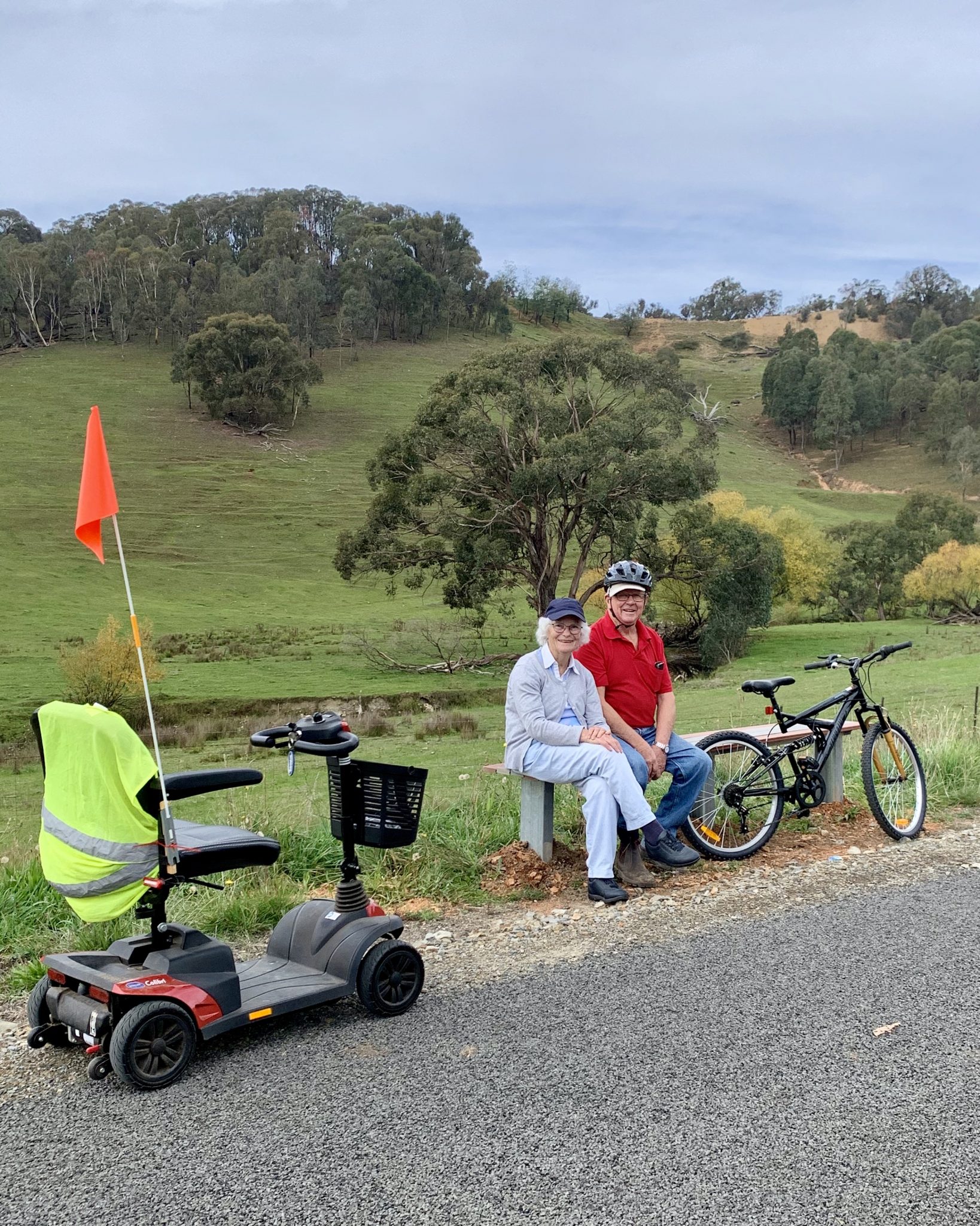
When I say ride, I actually mean you can walk, run, push a pram, ride in a mobility scooter or wheelchair… anything except ride a motorbike, vehicle or horse. Oh and you can’t walk your dog either – there are lots of reasons why!

Surface?
The trail is sealed the whole way for the myriad of users – as mentioned above. It is accessible for many groups as a result, disabled, young, old….everyone is welcome.
Rest points?
There are seats placed strategically along the rail trail so you can sit awhile and take in the amazing views, or you climb atop a cutting and find a quiet spot to sit. Just don’t venture into neighbouring farms or vineyards.
Fencing
The whole trail is expensively extensively fenced, after lots of engagement with local landholders. Grids have been placed to ensure the trail cannot be shut off by gates, so that it is a seamless trail.
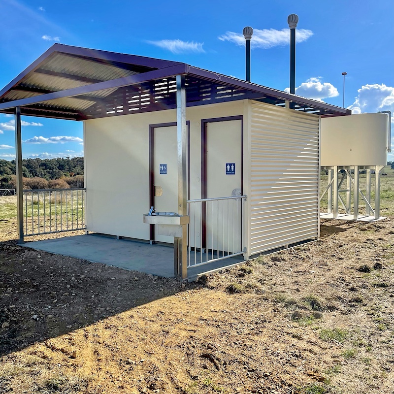
Toilets – Big news!
Great news as of 8 May 2021! We now have wheelchair accessible and unisex toilets at Figures St and Glenroy. Up until now the closest public toilets were in various locations in Tumbarumba and at Rosewood. They are very attractive looking toilet blocks and are a very welcome addition to the trail.


Food and Water
As with any adventure it is advisable to take your own supplies and ensure you carry your own rubbish out with you. There is water available in Tumbarumba and at the park in Rosewood, as well as at Gone Barny, on the edge of the Rosewood village. Food is available at either end of the rail trail.
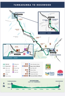
Distance each way is 21km
Starting point(s)
You can start at many places along the rail trail and ride bits and pieces, which may suit many families with children, who may not make the entire distance.
You may not think 21km is a long way, that is until you start to ride it with kids or those who aren’t quite as fit as they think they are. There are ample spots to stop and rest on seats along the way while soaking in the views. If you stop and think, 21km is half a marathon and if you ride back as well, then you’ve basically done a marathon of 42km!
See the map on the brochure – available at Visitor Information Centre or at the crew barracks at Figures St – for the many places to start your adventure.
Drop-off/pickup points along the way?
Here are the rough distances for planning a walk or a ride along the rail trail as per pickup/drop off points:
• Wolter Cottages (official Trailhead) to Figures St approx 1km
• Figures St to Camden Park Road crossing approx 1.2km
• Camden Park Road crossing to Jingellic Road approx 3km
• Jingellic Road to Sawpit Creek Bridge approx 1.2km
• Sawpit Creek Bridge to Glenroy Station approx 2.8km
• Glenroy Station to Glenroy Hills Road approx 3.7km
• Glenroy Hills Road to Wolseley Park approx 2.9km
• Wolseley Park to Gone Barny approx 5.1km
• Gone Barny to Rosewood Park (Trailhead) approx 1.1km
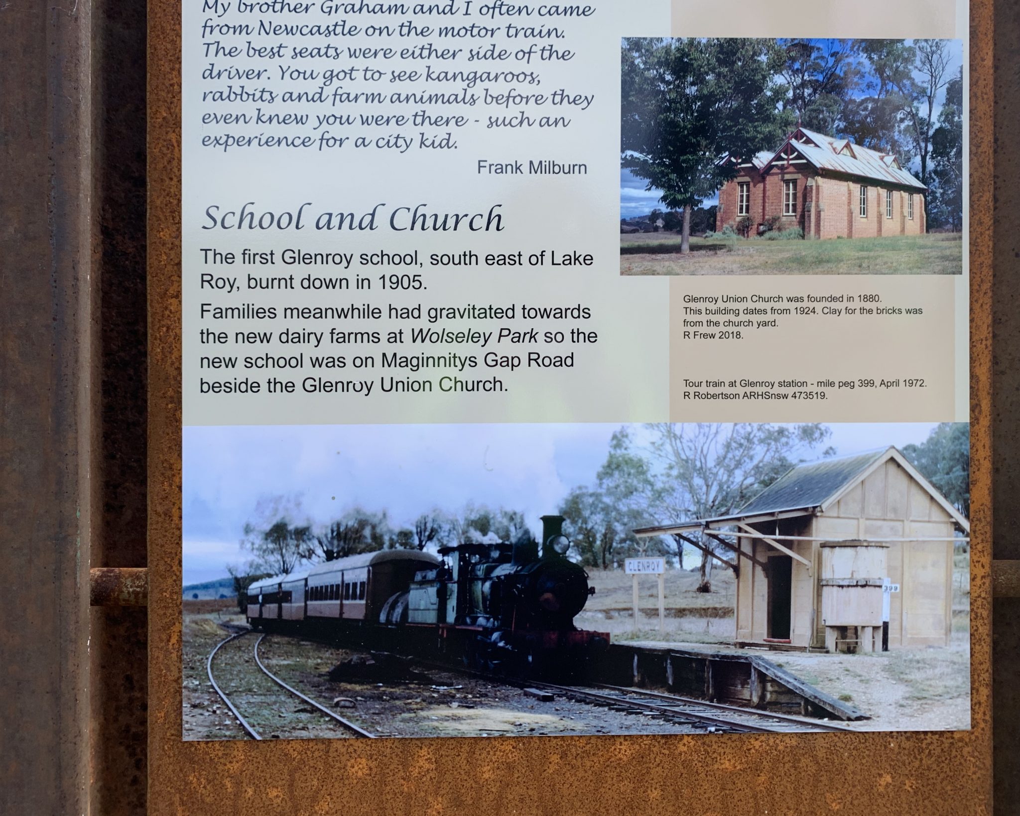
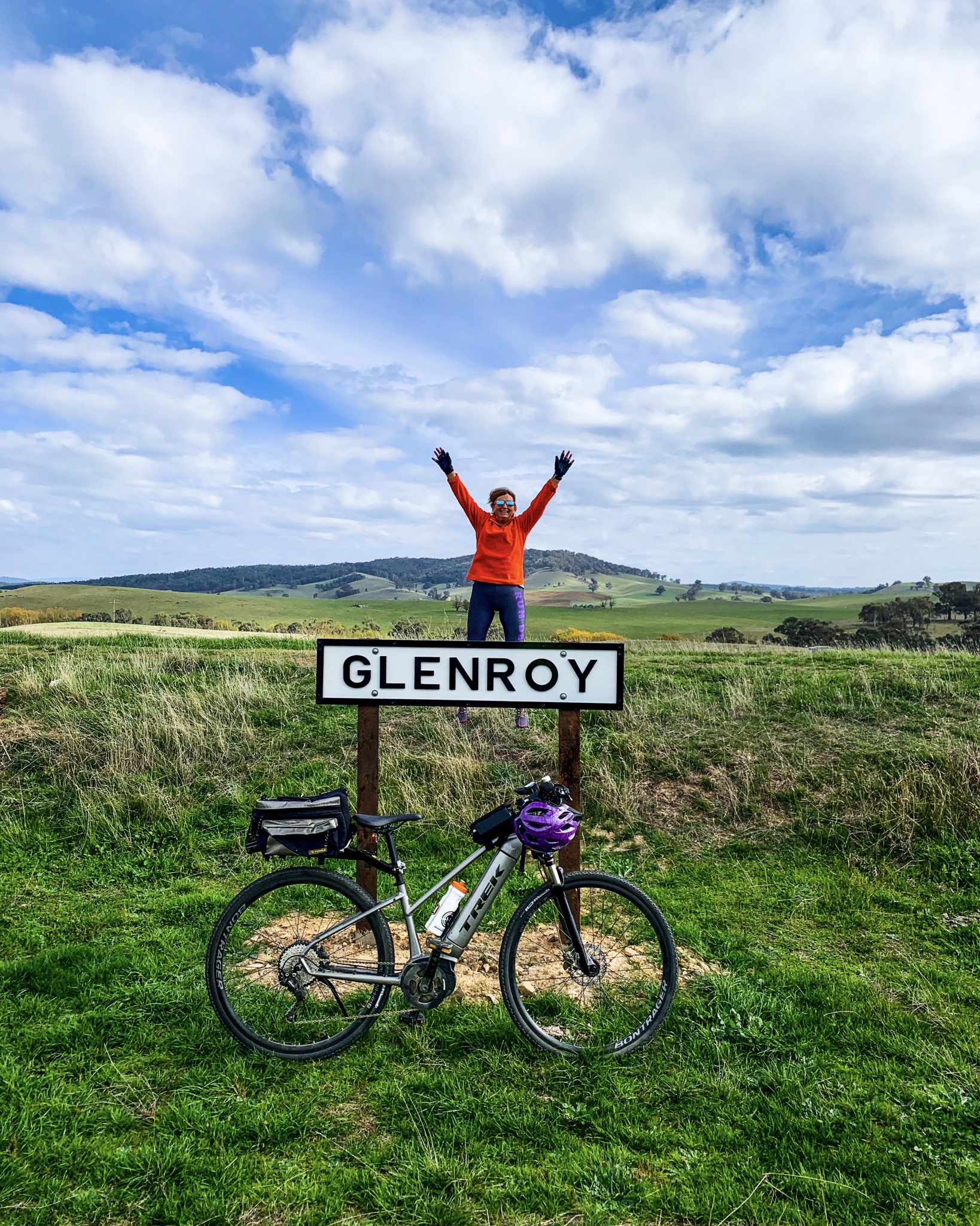
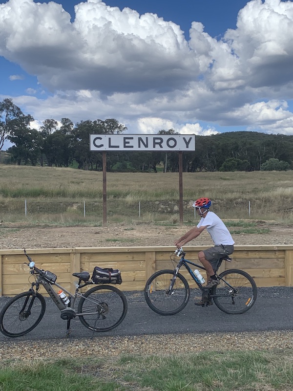
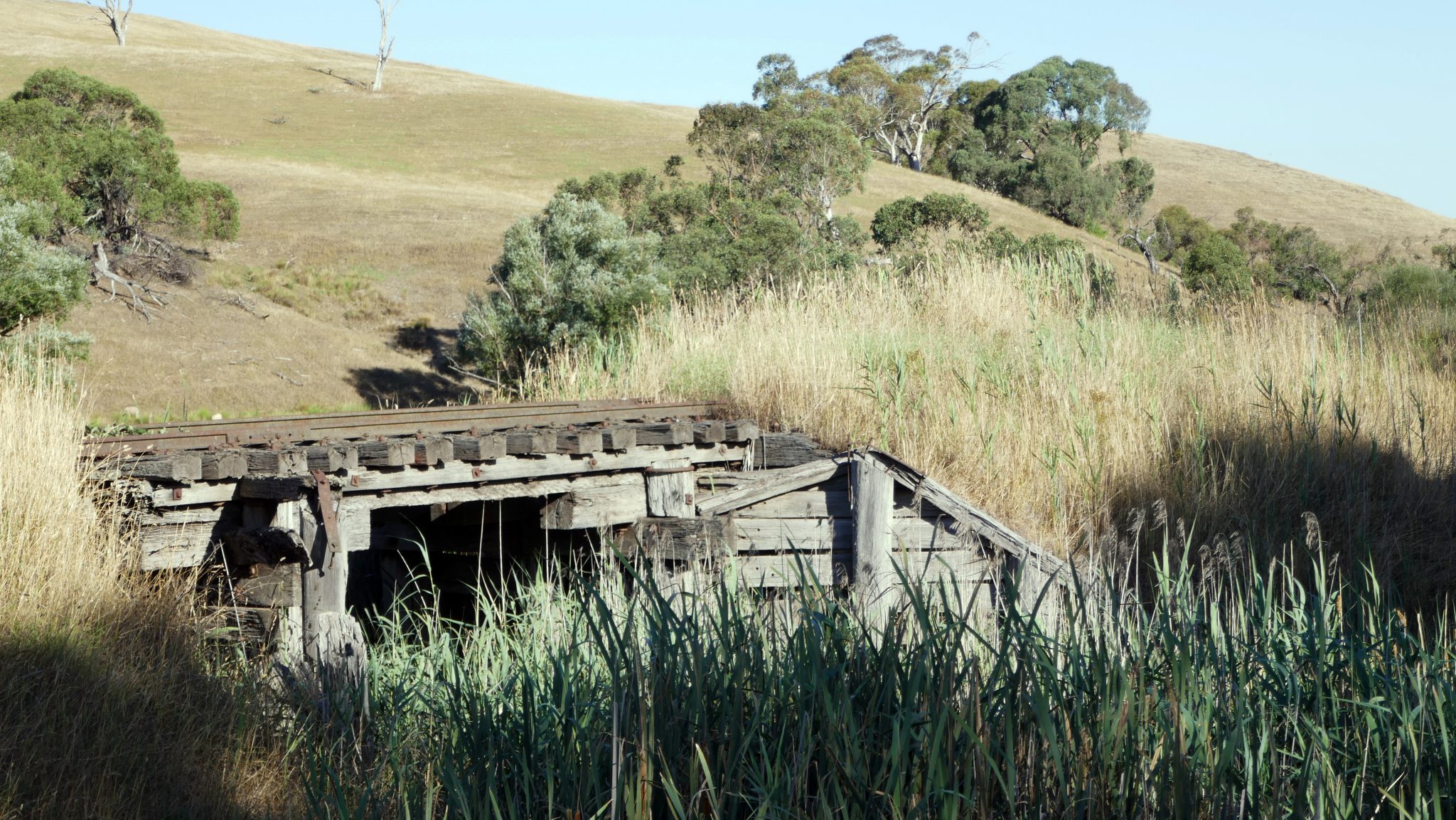
There were four railway stations along the way – Tumbarumba, Glenroy, Wolseley Park and Rosewood. None of these stations are still standing, although remnants of platforms can be found at Tumbarumba, Glenroy and Rosewood. The local Men’s Shed have recently completed upgrades of the platforms at Glenroy and Rosewood and they look great. The old Tumbarumba Station site, adjacent to the Figures St track-head, is no longer accessible due to it being part of the Bergin Logging Company.
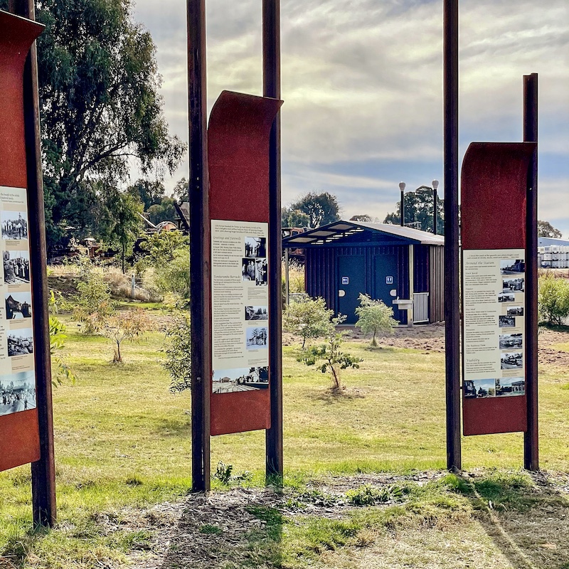
There are history information boards at each of the station sites and these tell interesting stories from long ago. Lots of railway memorabilia is still to be found in situ, so keep your eyes peeled for the various mile markers along the way.
There is also a Scavenger Hunt activity sheet available for the young and young at heart. These can be found at Tumba Bikes and Blooms, Ride Tumba, Visitor Information Centre , Rosewood General Store and Gone Barny at Rosewood.
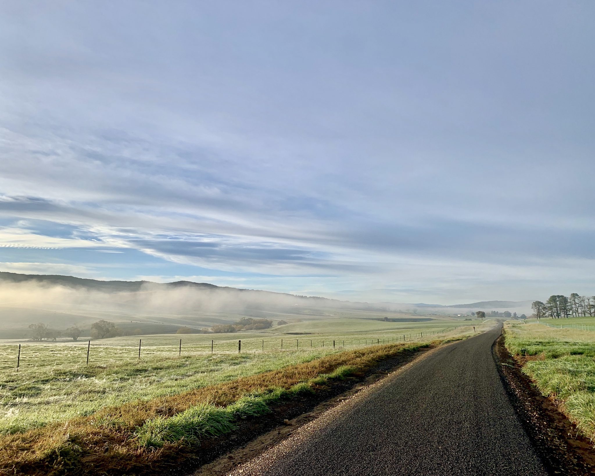
Although the railway line was built for steam trains, and the gradients had to be gentle to accomodate these engines, there are still some uphills and sweeping downhills, to contend with as you ride along.
The elevation starts at Wolter Cottages at 680m, Figures Street is 696m which is the highest point, before dropping to 573m at Sawpit Creek bridge. Glenroy Station sits at 555m and Wolseley Park Station is 570m before climbing into Rosewood Station at 604m. This doesn’t represent much of a climb but believe me, you feel it at times.
Hint: The ‘I think I can, I think I can, I think I can’ chant is useful when climbing up the last few kilometres into Tumbarumba after a ride along the rail trail.
The Little Engine that Could
You can start your ride at either Tumbarumba or Rosewood ends of the trail but be aware of the undulations of the trail and the elevation as noted above.
Track head
In the development plans, Wolter Cottages, on Albury St Tumbarumba, are named as the track head for the rail trail, but in actual fact the main area is at Figures St, as close as possible to the location of the original station. (Unfortunately the old station was removed and the land is now part of a private business).

Old railway station signs 
Railway station signs all cleaned up!
Figures St to Glenroy Station (approx 8.2km)
We’re starting our ride today at Figures Street in Tumbarumba, near where the old Tumbarumba station once stood.

rail trail sign on main road 
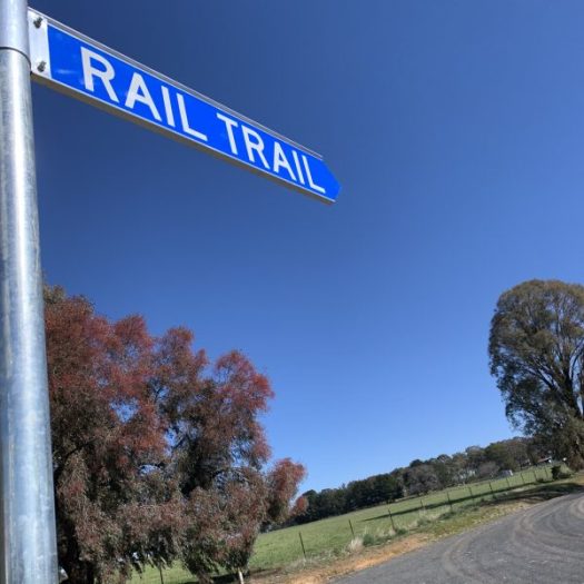
Figures Street is in a mainly industrial area of Tumbarumba and care needs to be taken due to the movement of trucks. It is best to access Figures St via Langlands St rather than Bell St or McMeekin St from the main Wagga Rd (Albury St). Blue signs have since gone up to show the way!
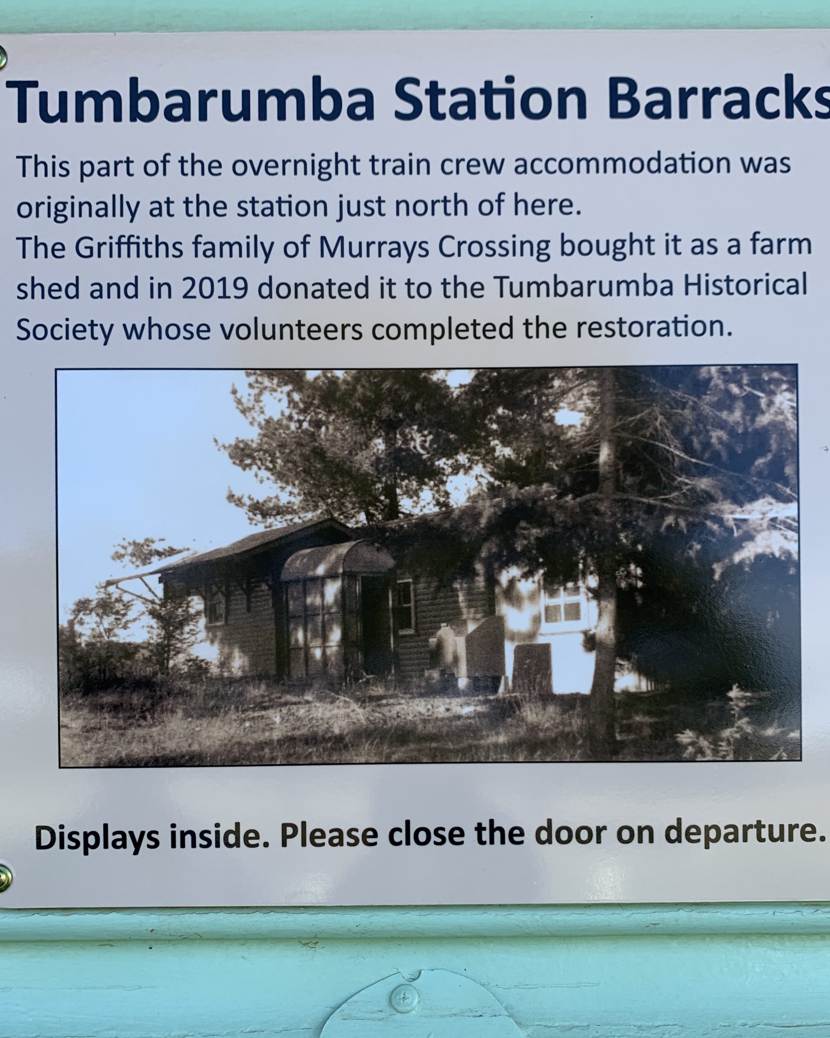
Figures Street has car parking, the original station sign (all cleaned up), information boards, old railway gates which have been renovated by the Tumbarumba Men’s Shed, an old barracks hut which was donated to the Historical Society and has since been converted into a display of construction photographs and a bike repair maintenance station. The Tumbarumba Historical Society, Men’s Shed members, many volunteers and council staff are to be thanked for helping to create this fabulous area.


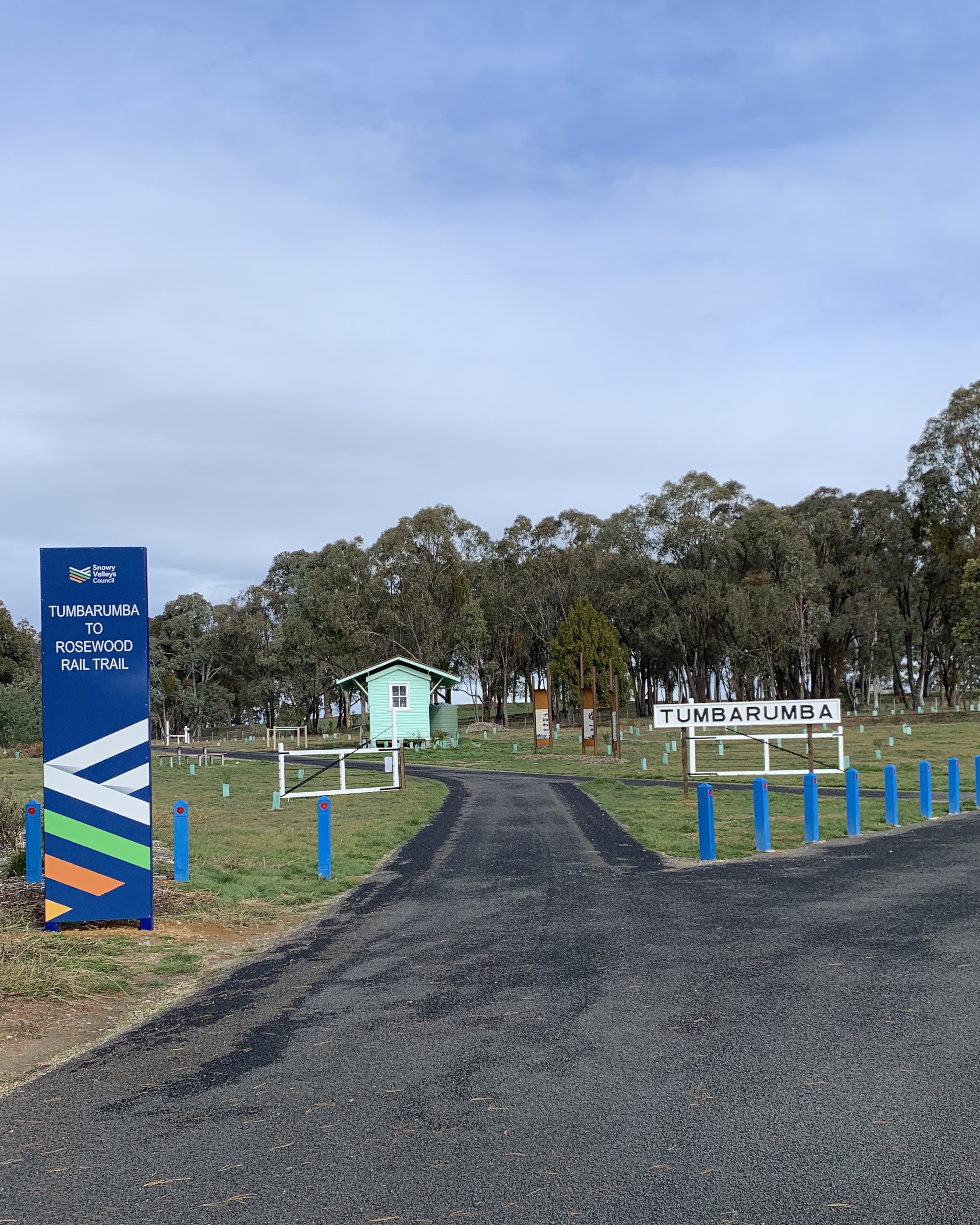

Three information boards from the Tumbarumba Historical Society stand nearby telling the story of the area. The area has been extensively planted with trees, with support from the local lands organisations and volunteers. There are picnic tables and bike racks, again made by the Men’s Shed guys. Now there is also a toilet block.

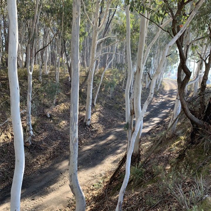

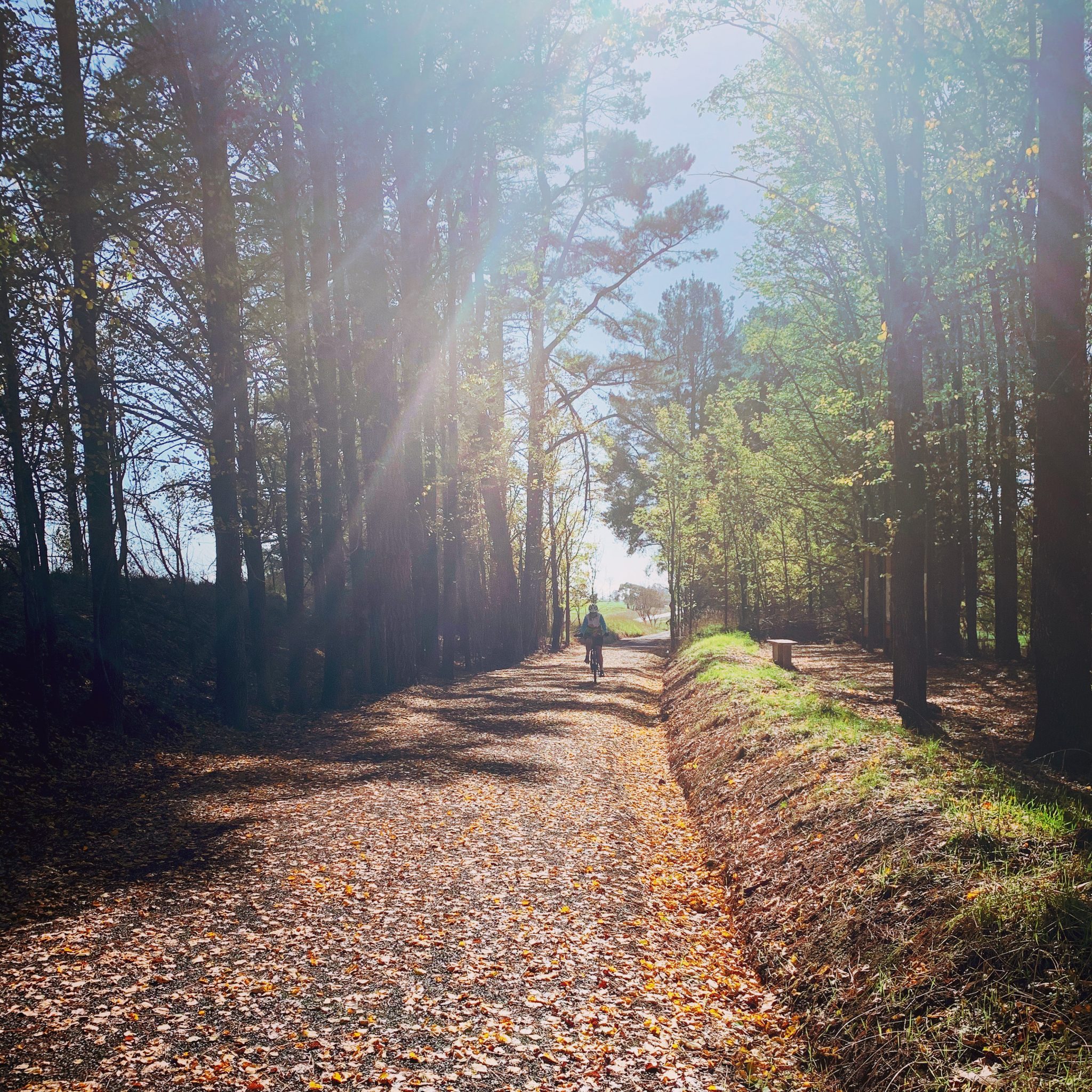
The ride from Figures St is a continuous and joyful roll downhill, through a beautiful cutting of white gums and out into farmland. The birds swoop and chatter as you ride along.
After about 4kms kilometres of glorious downhill, the trail comes to Jingellic Road, near the Hyne Timber Mill. This is a busy road and care must be taken when crossing it.


The trail continues right past the mill and unfortunately the beautiful stand of trees, which were alongside the trail, had to be bulldozed to allow for a fire break to be put in, when the bushfires of January 2020 raged through the area. It is a stark reminder of what our town has endured in the first few months of the year.
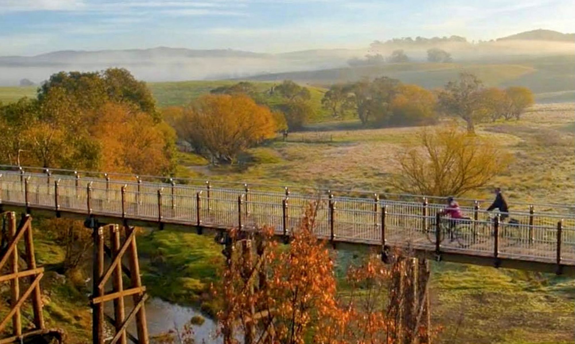
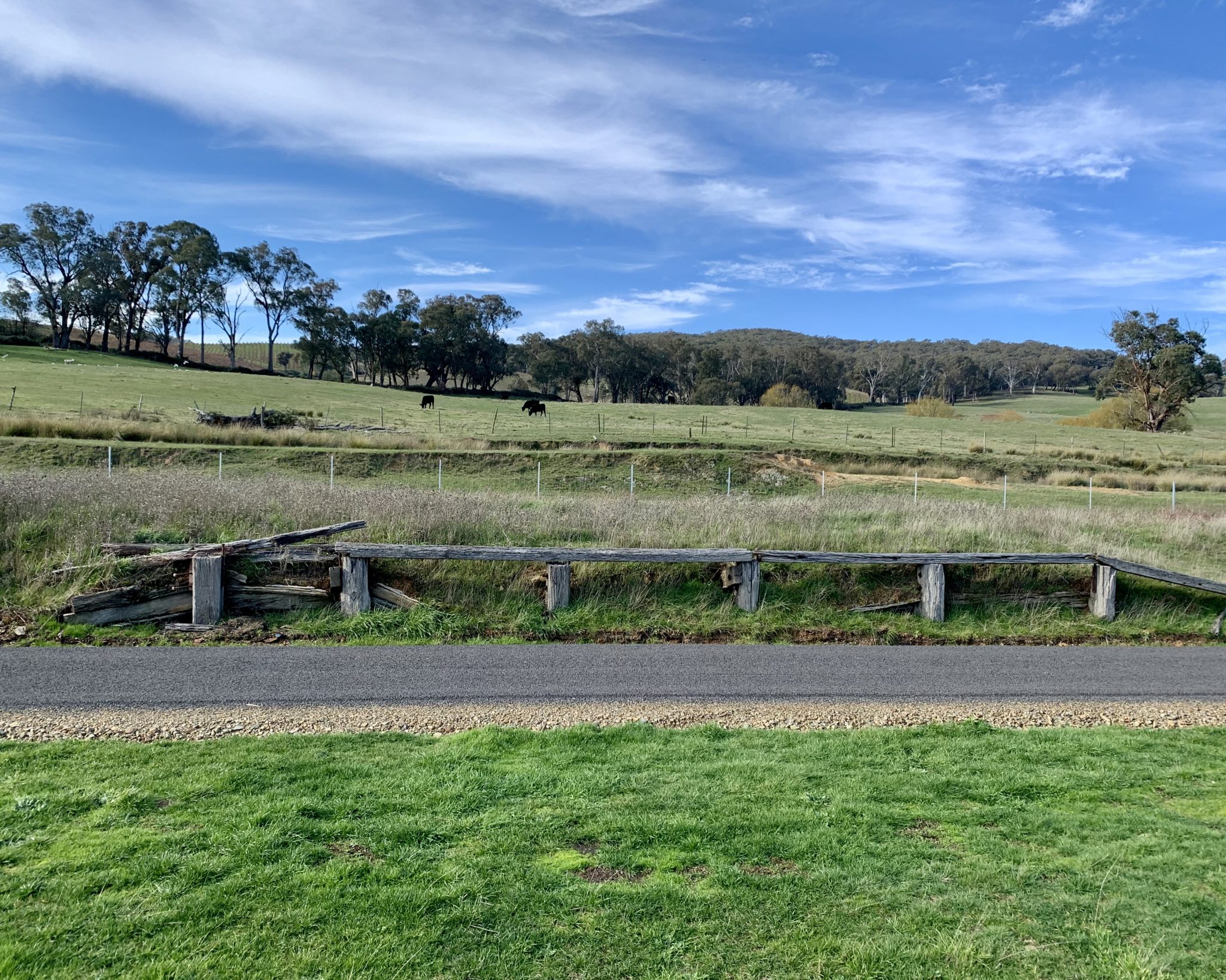
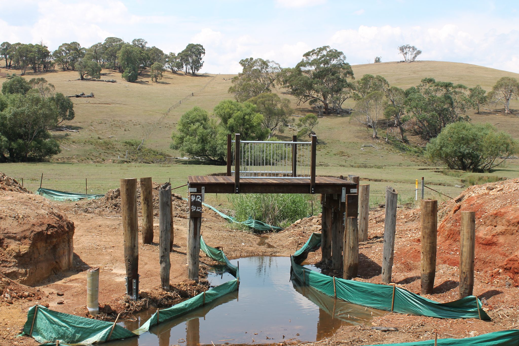
At the end of this section, we arrive at the first of the three trestle bridges which were rebuilt, this one is at Sawpit Creek. It’s a marvellous sight and one of the council workers has built a unique picnic table setting underneath so you can look up and admire the work that has been done to bring the bridge back from the wreck that it had become.


There is a carpark at Sawpit Creek and many people decide to start their walk or ride here to save their legs on the uphill section back to Figures St.
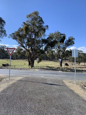
This is a major road crossing and care must be taken, as trucks and lots of traffic use this road. Once crossed, the rail trail continues, running parallel to the main road, before veering away from the road towards Glenroy Station.
The first of the many farm overpasses is just before the old Glenroy Station. These overpasses were built in consultation with farmers, to allow for their farming practices to continue with minimal disruption.
Glenroy Station sits nestled among green rolling farmland with spectacular views over vineyards and a blueberry farm nearby. There are historical boards telling the story of the station, a picnic table, a bike rack, a covered shelter and toilets, plus a pump – built by the local volunteers from the Men’s Shed. The station siding has recently been renovated by the Men’s Shed with funding form the project.


Glenroy Station to Wolseley Park Station 6.6km
Look to the south for lovely views down the lower Mannus Valley. Coppabella Vineyard is a 5* rated vineyard (James Halliday), featuring Chardonnay and Pinot Noir.
The corridor for the rail trail was rebuilt through the vineyard as it was removed (illegally) by a former owner of the vineyard. In the early days of the project there were indications that a cellar door would be opened to service the rail trail, hopefully this may still come to fruition in coming years. There is also a blueberry farm across the road and in autumn you can see the delightful colour of the bushes.
Down the slope out of the vineyard we enter the beautiful Mannus Creek Valley. Crossing the creek is the largest trestle bridge on the trail, beautifully restored by Timber Restoration Systems. In coming weeks a picnic area will be completed beside the bridge.


The trail rises slowly with outstanding views across the valley of rich cattle country and vineyards.
Take a moment here to stop and enjoy the seat with a view!
Up through a cutting and you arrive at Glenroy Hills Road. Just off the trail to the right is Lauren’s place which will be (hopefully) opening soon on weekends for coffee and cake.
Detouring to the left up Glenroy Hills Road, about 230m, the crest of the slope is reached, affording magnificent snow views of the main range and Kosciuszko itself.
Back on the trail you pass by an old vineyard, which is currently being returned to cattle country and then we ride through a big cattle property, where the black cattle calmly watch you as you ride by. There are three large farm overpasses along this section, all beautifully rock faced.
The trail loops around to the right and rejoins Mannus Creek albeit from above. A large cutting here provides warmth and quietness. Rock from this large cutting was used to fill the adjoining gully.
With the picturesque creek by our side again, we duck through another farm overpass to arrive at the beautiful Wolseley Park Station. This is a great spot for a picnic and to soak up the atmosphere!


Wolseley Park to Rosewood 6.2km
This section has the cute little Pigsty Creek bridge and the trail follows along the creek for some distance, with evidence of lots of active wombats. We now cycle parallel to the main road for a bit before moving through farmland again and the biggest farm overpass at 50 metres in length, basically a tunnel!
Another old bridge has been renovated over Bells Creek and unfortunately the trail narrows considerably here. We are starting to get closer to the small village of Rosewood now and a great spot to stop for a snack and a world famous (my recommendation) milkshake is at Gone Barny Eucalyptus Nursery, just off the trail as you enter Rosewood.
A further kilometre along is the Rosewood Park with toilets, play equipment and a toy train in the park. Parts of the old platform are still in place and there are now history boards and a picnic table added to the site. This is the end of this stage of the rail trail but there are hopes to have it continue on to Wagga Wagga eventually.


The End
Once you get to Rosewood you can decide if you want to turn around and ride back to Tumbarumba or be collected and driven back. But whatever you do I suggest a milkshake at Gone Barny first!
What is the Tumbarumba to Rosewood Rail Trail?
It started life as a railway line in 1921, having been conceived in 1884, wending its way from Wagga to Tumbarumba, something of an engineering feat given the times and conditions. The railway line was closed in 1974 and then was left to rot, disused and forgotten, until progressive minded locals started the ball rolling to convert into a shared pathway in 2003.
Yes it’s taken nearly 20 years of persistent hard work to get it to this stage.
The original plan was to convert the whole railway line to a rail trail, but due to the number of councils involved, it was decided to start with the one section within the old Tumbarumba Shire Council first. So the 21km from Tumbarumba to Rosewood section is the start of what we hope will one day be continued to Wagga, a distance of 130kms. We are a pilot case now for the rest of NSW in regards to rail trails.
This first section has now been rejuvenated into a shared pathway and the history and countryside have been opened up for all to use and enjoy, thanks to a grant of just under $5m from the State Government in 2015. The local council was given the job of construction with experts brought in for bridge restoration and lots of input from a local volunteer committee and community members.
Where exactly is Tumbarumba?
Tumbarumba is a small rural town, a hidden gem, in southern NSW, close to the Snowy Mountains. It is just off the Hume Highway, half way between Sydney and Melbourne and only a 2.5 hr drive from the nation’s capital, Canberra.
The population is only small (approx 2000), so to have achieved this rail trail is a testament to the many community minded people involved. It’s going to be a very popular trail given the proximity to some of Victoria’s Rail Trails just a short drive away, over the border.
We are fortunate to have committed volunteers in town who have not only managed to get the rail trail up and running but have also carved out mountain bike tracks, campaigned and received funding for a pump track in town and are supportive of cycling tourism.
There is now the option of hiring ebikes and even a baby chariot from Tumba Bikes and Blooms, call 0448295716 for a booking. There are lots of great cafes, restaurants, cellar doors, vineyards, a bakery and things to do in town, it’s small but it’s forward thinking!
A great resource
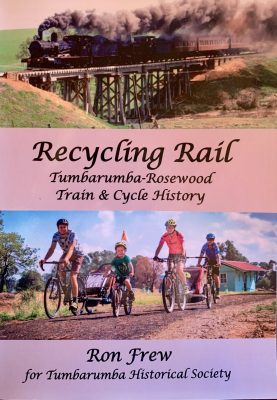
Local historians Ron and Cath Frew have written a book, Recycling Rail, which tells the history of the railway line, personal stories of local families, and the story of the rail trail. It is available for purchase locally or by mail for $30 plus postage, if you are interested please let me know in a comment below. All proceeds go to the Tumbarumba Historical Society.
Hope you can visit us soon
Well done to everyone involved, locals, volunteers, supporters, family, council workers, politicians, Tumbarumba Historical Society, Men’s Shed, Landcare organisations, cycling groups…anyone who has ever helped in any way – a big thank you.
It has been gratifying for all the hard working volunteers and construction workers, to see locals enjoying the newly opened rail trail during the lockdown period in 2020. As travel restrictions have lifted, we welcome the many others who want to ride or walk our fabulous rail trail, and our town needs you to visit us.
I hope you enjoyed the ride with me today, let me know what you think. If you’ve ridden or walked the trail, you can always write a review on our Facebook page or on Google.
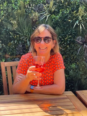
Yours truly!
Deb xx
UPDATE: 26/1/2021 – The Rail Trail Committee received the Community Group of the Year 2021 at the local Australia Day ceremony.
Winner of the best Community Group – The Tumbarumba Rosewood rail trail committee. After many years of hoard work negotiations, submissions and reports combined with countless meetings this group, headed by Owen Fitzgerald, finally saw their dream come true. The Tumbarumba to Rosewood” rail Trail was completed in April 2020. The fact that this is the first Rail Trail in NSW is a remarkable achievement and reflects the efforts and numerous frustrations experienced by this group. The result of their predictions, work efforts and site promotion can be seen by all. The recorded utilisation of the site is a true reflection of how this rail trail will remain as a long term tourist attraction. An economic asset for the shire. It will be the bench mark for any future rail trail development.

UPDATE: 22/8/2020 – it snowed on the rail trail! It doesn’t happen very often so when it does we have to make the most of it! If you’d like to see some photos click this link A snow day on the Tumbarumba to Rosewood Rail Trail

If you’d like to follow our Rail Trail Facebook page then click here: https://www.facebook.com/tumbarumbarailtrail/
Follow on Instagram: @TumbarumbaRailTrail

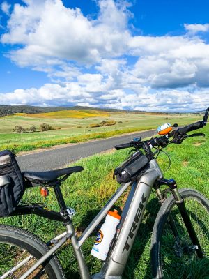
Note: I ride a Trek Dual Sports+ ebike and love it! Thanks to my husband, the Mathematician, for some words and editing support. I have tried to use only photos taken by myself or my husband, or those in the public domain, but if I have inadvertently used a photo you have taken, I thank you for sharing.
Some of my other rail trail posts can be found here
You can also find Deb’s World in lots of other places – stay in touch by clicking any of the buttons below.
Everyone has a story to tell!
Deb is a young-at-heart & active 60+ blogger/retiree, after being made redundant from her 22-year career managing education programs in a men’s correctional centre (jail). She now spends her time reading, blogging, riding her ebike and travelling. Deb was awarded a Bravery Award from the Queen when she was 17 after a tragic accident – a definite life changing moment! She is married with 3 grown-up daughters & has 4 grandchildren. You can read more of Deb’s story here


ooohh this trail sounds amazing! I love all the photos and information
LikeLiked by 1 person
What a great resource, Debbie. I love how you shared this extensive information on the project and hope the organization appreciated your efforts. What you wrote is quite similar to my article on the Centennial Trail for the paper–even the boots on the ground (bike tires) research!
LikeLiked by 1 person
Thanks so much Terri, it has been appreciated by many users and I love talking to people who ride the trail who mention they found my post!
LikeLiked by 1 person
I would love to do this cycle route, and you have done a fantastic job promoting it, Deb. Here’s too many more people heading in your direction to enjoy being in the countryside. Not to forget the biggie, the cycle route having toilets, now that is a big plus 😉
LikeLiked by 1 person
It’s been so fabulous for our town Suz!
LikeLike
Wow! What a fabulously diverse journey. Hurray! and congratulations! that your committee’s efforts were recognised! You were instrumental in historical & nature preservation!
LikeLiked by 1 person
Thanks Ju-Lyn, we’re all very proud of our efforts and love seeing others out enjoying themselves.
LikeLike
How wonderful that you are able to enjoy others delighting in your efforts. Preservation is such a crucial endeavour – and to make it accessible to the public, a treasure!
LikeLiked by 1 person
Good morning, is there a place to camp at Rosewood?
Kind regards
John
LikeLiked by 1 person
I’m not sure John, the Rosewood Golf Club used to have camping available but you would have to check with the Visitor Info Centre 0269483333 or on the Snowy Valleys Council website. There is free camping nearby and Tumbarumba is only 21kms away with a caravan park and free camping spots. Hope that helps.
LikeLike